New green infrastructure tool helps inform Indiana communities’ resilience planning

Arbor Day in Indiana may have started as a celebration of trees, but in a time of rampant environmental change, it’s also a celebration of resilience.

A new tool created by Indiana University researchers is helping Indiana local governments maximize the benefits of urban trees and other green infrastructure to become more resilient against the impacts of climate change.

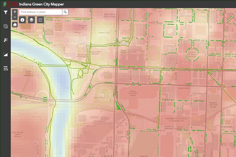
Indiana Green City Mapper, a statewide spatial inventory, charts six forms of green infrastructure—urban forests, green roofs, parks, greenways and trails, urban food gardens, and green stormwater infrastructure—across Hoosier communities, pairing this information with socioeconomic and climate change-related data to help inform resilience planning. By leveraging natural systems, community decision makers can economically reduce risks posed by climate change impacts, such as increased precipitation and hotter temperatures. The project was funded by IU’s Environmental Resilience Institute.

“Green infrastructure is an incredibly important and powerful way to address climate change challenges,” said Heather Reynolds, an associate professor in IU’s Department of Biology and project co-lead. “Just as cities and towns have resources to manage gray infrastructure—things like paved surfaces, buildings, and sewers, they also need resources to manage green infrastructure. Indiana Green City Mapper brings all of this data under one roof, giving Hoosier communities a comprehensive view of their green assets and the assets of surrounding municipalities.”

Currently, the mapper contains detailed green infrastructure data for Indianapolis and Bloomington and urban forest data for 27 Indiana cities and towns. Users can explore 16 different data layers, ranging from urban tree inventories, parks and other greenspaces, to local climate zones, a measure of heat exposure.

To build the mapper, the research team partnered with local governments, state agencies, nonprofits, and others to acquire existing datasets and build new ones. Partners on the project include Davey Resource Group, Citizen Energy Group, the Indiana Department of Natural Resources, the Indiana Geological and Water Survey, the Indiana Association of Soil and Water Conservation Districts, and Keep Indianapolis Beautiful.

Even within organizations, however, researchers found green infrastructure datasets oftentimes resided in separate departments, making it difficult for anyone to see a complete, community-level green infrastructure overview.

“We wanted to build a tool that brings all the forms of green infrastructure together,” said team member Sarah Mincey, an associate professor in the O’Neil School of Public and Environmental Affairs. “As we continue to add to the mapper, we want it to become a repository for data that might be hard to access otherwise.”

A screenshot of the Indiana Green City Mapper map displaying data related to trails, trees, green stormwater infrastructure, and land surface temperatures in downtown Indianapolis. Users can select from 16 different data layers within the tool.

With more Indiana cities developing plans to reduce local emissions and become more sustainable, Indiana Green City Mapper can help local government staff meet long-term goals related to carbon sequestration, flood mitigation, biological diversity, and reduction of heat islands. For example, in its recently adopted climate action plan, the City of Bloomington outlined actions to increase the quantity and quality of greenspace with the community.

“As we implement our climate goals, tools like Indiana Green City Mapper will help us plan and make decisions,” said Lauren Travis, the city’s assistant director of sustainability. “For instance, we have an ordinance that encourages green roofs, but it can be difficult to track their prevalence. Being able to see where green roofs pop up over time is helpful.”

Over the last century, Indiana’s average annual rainfall has increased about five inches, with more rain falling in heavy downpours. With even higher quantities of rainfall projected in future decades, urban tree planning can play an important role in helping communities contend with wetter weather. Urban trees also provide shade to residents on hot summer days and habitat for wildlife.

Recognizing trees and tree canopies for the ecosystem services they provide—not just their aesthetic value—is a positive step for Hoosier communities’ resilience, said Carrie Tauscher, the Indiana Department of Natural Resources’ State Community & Urban Forestry Coordinator.

“Based on inventory analyses across the state, over 50 percent of the ecosystem services provided to communities in Indiana are based in stormwater mitigation,” Tauscher said. “Our communities need to look at their trees as stormwater infrastructure that grow in capacity over time.”

With Bloomington and Indianapolis now well documented, IU researchers are looking to incorporate more green infrastructure data for other Indiana cities into the mapper and add new data layers for volunteer groups that help care for public greenspaces.

Explore Indiana Green City Mapper

About the Environmental Resilience Institute

Indiana University’s Environmental Resilience Institute brings together a broad, bipartisan coalition of government, business, nonprofit and community leaders to help Indiana better prepare for the challenges that environmental changes bring to our economy, health, and livelihood. Launched in May 2017, ERI is working to deliver tailored and actionable solutions to communities across the state of Indiana.