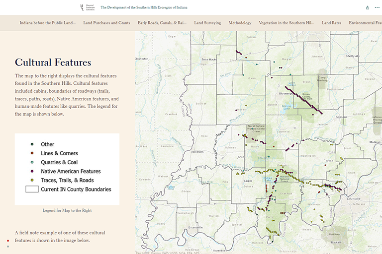
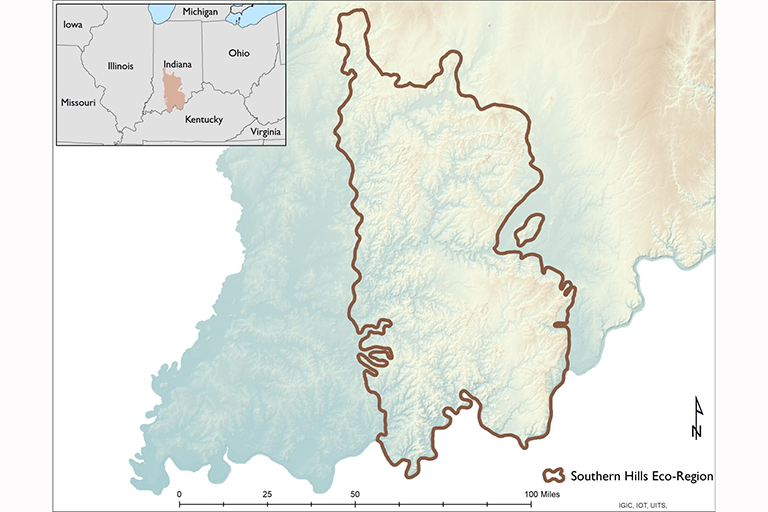
Indiana University students, faculty, and staff have created an interactive map which documents the cultural, environmental, and topographical history of the Southern Hills ecoregion of Indiana, an area that cuts down the middle of the state from Greencastle to New Albany.
The Development of the Southern Hills Ecoregion of Indiana was led by John Baeten, visiting assistant professor in the Department of Geography at IU Bloomington, and created through an ERI grant.
The project reconstructed Indiana’s historical environment over the past 200 years by collecting and digitizing documents from a variety of sources, including records of U.S. General Land Office surveyors from the 1800s.
"Many of these records were created by surveyors who had a goal of making this vast landscape into a decipherable rectangular grid system," Baeten said. "By the end of our efforts, we ended up with more than 36,000 lines of data which detailed vegetation, hydrology, and cultural information collected by land surveyors for this area."
Data collection for the project occurred over the course of several years, with faculty and about a half-dozen undergraduate students collecting and digitizing the data. At times, students had to physically travel to locations where the records were preserved and take photos of the documents in order to convert them into a usable format to be put into the map.
In addition, the team relied on plat maps, a guide to a tract of surveyed land, from across the region to collect information about land values, purchases and grants, and early infrastructure, such as roads and bridges, which dotted the landscape during the time frame.
“We looked at the historical context that went along with the notes, including research journals, historical maps, and pictures in order to paint a complete picture of what was happening in the past, not just environmental developments,” said Cara Sullivan, an IU alumna who worked on the map’s creation during her time studying environmental science and history as an undergraduate.
Once the historical records were collected and digitized, the team was faced with the challenge of making the information accessible to Hoosiers and other viewers.
“The biggest challenge was scaling everything into a story map,” said Sullivan. “When we set out to write the narrative to go with the maps, we had a 20-plus page historical essay and we thought people wouldn’t want to read that. We aimed to preserve as many of the facts as we could in a digestible way.”
With the story map now published, Baeten has high hopes for its practical applications in the region, especially as an educational source for K-12 students who want to learn more about the natural history of their home state.
"Whether it is looking at historical forest composition in the Hoosier National Forest or looking at wetlands, which Indiana has lost about 85 percent of, that information can be found in this map," Baeten said. "Over 200 years, we've lost a lot of the state's ability to manage floods and other natural disasters in a natural way. With this map, we can identify where those features once were."
Sullivan, whose passion for the project convinced her to pursue graduate school, is also hopeful for the map's potential to guide the decision making of policymakers and local stakeholders in the Southern Hills region.
"I would hope that conservationists use our maps to inform current decisions based on what we know the landscape was like 200 years ago," Sullivan said. "I hope that ordinary citizens will look at it and be interested in what was on their land 200 years ago. I hope everyone finds something interesting and practical about the tool."
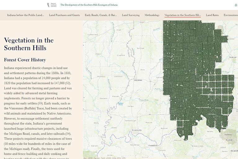
The interactive map also includes other information, including robust records of tree canopies, vegetation cover, and observations of Native American cultural sites and artifacts. Reviewing the history of colonization and environmental injustices experienced by Native Americans, the map sheds light on the way tribes inhabited and interacted with the landscape.
Above all, Sullivan said, she hopes that the map illustrates how much fun it can be to learn about a specific part of the country.
"History isn’t boring," said Sullivan. "It's not this big foreign thing that people shouldn't want to learn about and it can be fun. It can be presented in a format with maps and be interactive, it doesn’t have to be just a textbook."
About the Environmental Resilience Institute
Indiana University's Environmental Resilience Institute brings together a broad, bipartisan coalition of government, business, nonprofit and community leaders to help Indiana better prepare for the challenges that environmental changes bring to our economy, health, and livelihood. Launched in May 2017, ERI is working to deliver tailored and actionable solutions to communities across the state of Indiana.


