Assessing the Potential for Reducing Peak Flood Flow and Enhancing Summer Base Flow in the St. Joseph River Basin

Investigating natural flood control solutions

The Elkhart River at Baintertown Park. Image credit: A R Buschert, Wikimedia Commons (CC BY-SA 4.0)

The Problem

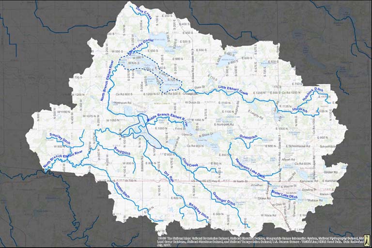
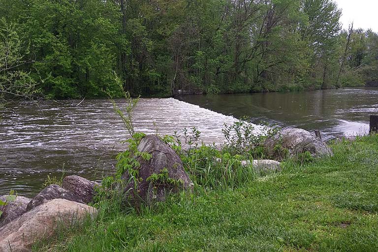
The St. Joseph River Basin and other watersheds in Indiana have experienced heavy spring flooding in recent years exacerbated by environmental change. Without better alternatives for managing waterways, government units will likely default to traditional flood control solutions, such as river channelization and large, costly reservoirs, to deal with increased flooding. These infrastructure projects come with high environmental costs, including loss of biodiversity and social and ecological damage.

The Project

A team led by Bill Weeks of IU’s Maurer School of Law, partnering with Burke Engineering and the St. Joseph River Basin Commission, explored the potential for utilizing natural lowlands along the North Branch Elkhart River (NBER) basin in northeast Indiana to enhance flood control, an approach that has the advantage of restoring natural water management systems.

With a focus on the geology, climate, hydrology, hydraulics, and geomorphology of the river basin, the team conducted site visits, reviewed historical aerial photography, and gathered data related to streamflow, lake stage, rainfall, topography, and soil to conduct its analysis. The team also created a preliminary hydrological model of the watershed to quantify how water moves through the system and to evaluate the potential benefits of creating additional flood storage basins. Input from local stakeholders gathered over the course of two public meetings helped inform the team’s study.

After conducting its analysis, the team concluded that enhancing existing lowland areas for flood control would not be cost-effective to reduce existing flood issues in Noble and LaGrange Counties because of the natural characteristics of the watershed. For a groundwater-fed watershed like NBER, additional upstream storage would likely have little impact on reducing flood intensity, the team reported.

Watersheds that may be good candidates for alternative flood control solutions include those that lack a natural capacity for absorbing heavy precipitation and those that are primarily surface water-fed.

The Path Forward

In its final report, the team produced maps for NBER stakeholders that indicate areas that should be protected from further development as well as areas that may be suitable for development.

The report also includes a series of recommendations to increase stakeholder resilience to higher lake levels and flooding patterns. The recommendations include developing and adopting location-specific flood resilience strategies, updating stormwater and floodplain regulations, and considering a higher flood protection grade when permitting new construction.

The recommendations identified in the report can also help inform the management and development of similar watersheds in the Midwest.

Updated March 19, 2021

A map of the North Branch Elkhart River Corridor watershed covered in the study. Christopher B. Burke Engineering