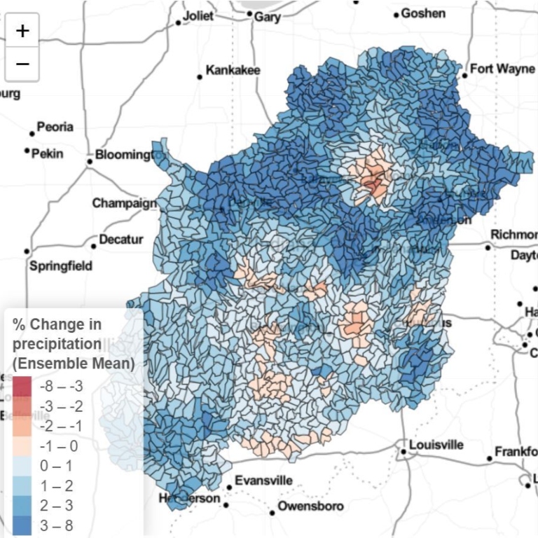
Increasing temperatures due to climate change are likely to reduce the amount of water in Indiana’s soil and streams over time, despite modest projected increases in average annual rainfall, according to a study by Indiana University researchers.
The findings, published earlier this year in the journal Water, are the result of a highly detailed model of Indiana’s largest watershed, the Wabash River Basin, which covers about two-thirds of the state. Simulated through the year 2100, the model teased out long-terms trends that may negatively affect water availability and agriculture.
“Under a changing climate, rising temperatures will increase soil moisture and hydrological drought, meaning Indiana’s soil and streams will likely be drier for longer periods of the year in future decades,” said University of Wisconsin-Stevens Point Assistant Professor Jennifer Dierauer, a former IU post-doctoral researcher and lead author of the paper.
Seasonal shifts in precipitation could become an additional stressor on Indiana surface water, according to the researchers’ model, as periods of rain in the winter and spring and periods of drought in the summer and fall become more common.
The project is led by IU Professor of Earth and Atmospheric Sciences and Haydn Murray Chair Chen Zhu. Additionally, students and staff across multiple university units contributed to the modeling effort.
Indiana climate scientists have already projected the state is likely to experience more hot days, wetter springs and winters, and more extreme rain events as a result of climate change. How these conditions translate to water supplies on the ground, however, is not as well understood.
Using an ensemble of climate models provided by researchers at the University of Notre Dame and applied in the latest Indiana Climate Change Impacts Assessment Report, hydrological modeling software produced by the US Department of Agriculture, and datasets encompassing Indiana’s elevation, land use, land cover, soil types, and streamflow, IU researchers developed its regional-scale watershed model on IU’s formidable computing infrastructure, including Big Red series supercomputers.
The results of the model have been made publicly available through the Future Water science gateway.


