Tracking Migration

Capturing bird population trends

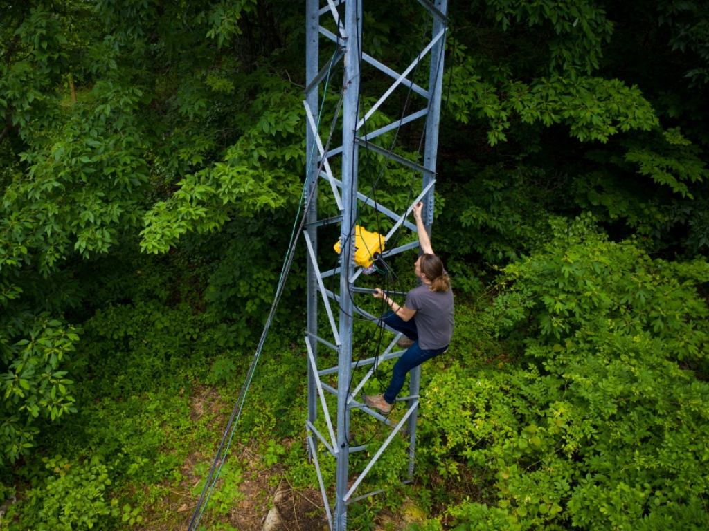
Allison Byrd, a research assistant at ERI, climbs a tower to check on a Motus Wildlife Tracking System at the T.C. Steele State Historic Site. Photo by James Brosher, Indiana University

The Problem

Migratory birds provide essential ecological services such as pollination, seed dispersal, and insect control while also harboring the potential to transmit disease to humans and other wildlife. Over the past half-century, bird populations in North America have decreased by three billion, or about 29 percent.  To protect birds and prevent disease transmission, a better understanding of bird migration is needed.

The Project

Using multiple technologies and techniques, including Motus stations, GPS tags, and stable isotopes, a research team at IU is tracking wildlife more effectively and economically than ever before.

A core component of this work is setting up and managing tracking stations at the T.C. Steele State Historic site, the Morgan Monroe State Forest, and the Kent Farm Research Station as part of an international collaboration called the Motus Wildlife Tracking System, a program of Bird Studies Canada. The stations have multiple antennas, cables, and a receiver that detect nanotag devices on nearby birds. When a bird flies by one of the stations, the tag is picked up and recorded. Every few months, a member of the research team will download the station data and upload it to Motus where it can be viewed by the global research community. Using the vast Motus system of approximately 700 stations, researchers can track more birds over larger geographic areas and track birds across their entire migration.

From December 2020 through April 2021, the ERI Motus stations collectively made 113 detections of tagged birds. While some of these birds were tagged locally, others migrated from places such as British Columbia. The team has also worked with researchers from other institutions to confirm detections that will inform their research.

As part of this project, the IU research team has tagged 38 male juncos, a type of sparrow, to learn about the timing of their departures and migrations. This information will help researchers understand how juncos’ migratory patterns relate to environmental conditions, pesticide use, infectious diseases, and climate change.

The Path Forward

The researchers are continuing to download bird data and submit it to Motus. IU researchers are also planning to assist the Indiana Department of Natural Resources as more stations are established throughout the state under a recent wildlife grant.

For the junco study, the researchers are investigating new ways to tag more birds and gather migratory data. During migration, the team will continue to look at the departure information from its South-central Indiana stations to see if the birds have been detected and track their passage.

Updated June 2, 2021

Project Data

Through Motus stations and nanotags, ERI researchers are providing information on birds and their migrations.

The stations record data on the birds they detect. The information is then transmitted to the Motus database.

Along with this information, the researchers are looking at when the juncos they are monitoring depart from the station on their migration. They are also collecting data on the birds’ health during the capture/tagging process and the environmental conditions that may impact departure.

The Motus stations contain multiple antennas, cables, and a receiver. This equipment can be placed on existing structures, but a small, new structure was erected for the Kent Farm Motus Station. The equipment detects the pulses of nanotags of birds that fly by. The data is retrieved every three months by a member of the research team, cleaned up, and sent to the Motus database.

For the juncos, the research team is placing nanotags on the birds and monitoring their activity to determine when they depart the wintering grounds. They are also collecting blood samples to look at incidences of diseases such as malaria.

The station reports on the date of detection, the location of and date when the tag was originally deployed, the species of the bird, and the latitude and longitude of where the tag originated.  

The data is in spreadsheets and a virtual timeline.

The data is available online from Motus. The data is updated every couple of months.