Urban Green Infrastructure Inventory and Analysis

Using data to create greener, more resilient communities

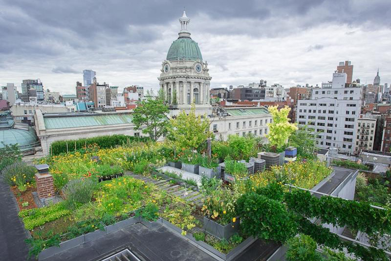
A green roof in Bloomington, Ind. brings co-benefits to the surrounding area, including shade and lower air temperatures.

The Problem

Urban green infrastructure (UGI), such as trees, rain gardens, and bioswales, stands apart from “gray infrastructure,” like gutters, pipes, and tunnels, by absorbing and filtering stormwater naturally and providing multiple co-benefits to communities.

Strategic implementation of UGI contributes to flood prevention, water treatment, and cooler surface temperatures during the hottest times of year. In Indiana, communities that want to expand their UGI and maximize its benefits require a comprehensive picture of existing social, built, and natural capital assets.

The Project

Led by IU professors Heather Reynolds and Jeff Wilson, a research team is applying social-ecological systems theory and an explicit resilience trait-based framework to guide the inventory and analysis of UGI in Indiana communities towards optimizing community resilience.

Working with the Indiana Geological and Water Survey and municipal partners, the team developed geographic information systems (GIS) layers for biophysical and social data associated with Hoosier urban forests, food gardens, and other vegetation, as well as layers for heat and flood risk and socioeconomic vulnerability.

The team incorporated this data into the Indiana Green City Mapper, a free tool that allows users to overlay map layers of climate and infrastructure data. These layers are designed to help cities prioritize the placement of UGI where climate change threats are greatest, both in terms of biophysical factors (e.g. heat stress, flooding) and social vulnerabilities (e.g. income levels, food insecurity).

The Path Forward

The team has already completed extensive data implementation in Indianapolis and Bloomington and is now collecting data on other cities and county seats in Indiana. Partial data sets for around 100 cities, towns, and counties across the state are being expanded.

Gathering this data can advance urban social-ecological resilience theory and develop best practices for taking inventory and analyzing multiple forms of UGI. Such a framework will assist municipalities across Indiana in strengthening their resilience to climate variability and change and contribute to healthier, more livable communities.

Additionally, the tool is being used by Beat the Heat communities and Keep Indianapolis Beautiful to guide implementation, raise awareness of environmental concerns, and publicize how urban forests make communities healthier.

Researchers plan to partner with ERI’s Resilience Cohort communities and IU students to further data collection.

View Indiana Green City Mapper

Updated Aug. 11, 2022

Project Data

Data from this project is free and publicly available through the Indiana Green City Mapper tool.